In Bloomington, Indiana there is a University, namely Indiana University Bloomington. Near this Place of Higher Learneding there are Places of Higher Dwellering, where people sleep and copulate and make Cup ‘o Noodles over hot plates. Some of these hot plates are closer to campus than others, and thus are in high-demand. They are demand because no one wants to wake up early and commute to school, because they realize they’ll soon enough finish school and commute for the rest of their miserable lives.
One of these hot plates in particular is so close to campus, and so in-demand, that they’re now leasing for the 2009-2010 academic year, which is so far in the future that by then we’ll be “so over” jet packs and will have moved on to Pogs and slap bracelets.
How close, you ask, is this hot plate to the University? That’s difficult to say. Like Digg, Brownstone Terrace seems to have a difficult time separating truth from falsehood. I present to you the following map, which I found on their Intertron Perma-Location Space:
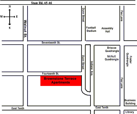
“Note: Map is not to scale.” Perhaps no ill was intended, but it’s interesting that this map selectively omits roads that would have inconveniently placed their property further from campus than would be desirable. Upon further investigation, it becomes clear they have compressed four north-south blocks and six east-west blocks into one single block. They even went so far as to remove the train tracks that run a mere fifty feet from their property. Awesome!
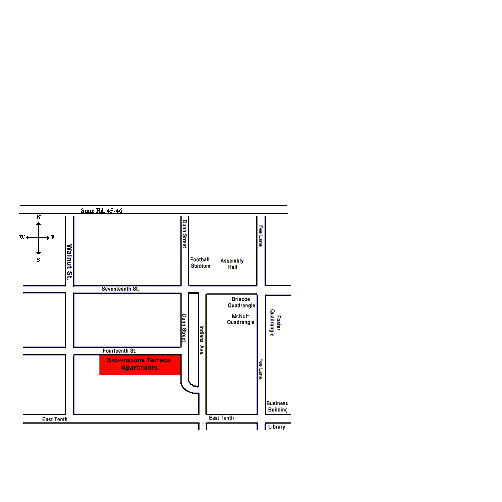
Now, as entertaining as this misrepresentation might be, I’m a sucker for reality, and thus took it upon myself to make a more accurate map. I turned to the only source of objectivity left in the world (because if Google says so, it’s got to be true!), worked out an overlay in Google Maps, and updated their map to reflect distances more accurately:

Click the image for a full-size version because, like, shit’s a lot further away than it used to be and it doesn’t all fit anymore. As it turns out, about the only thing they got correctly to scale was the size of their property itself.
Here’s an animation that layers the new map on top of the old map, and shows the overlay from Google Maps. Again, click for a mo’ bigga version:
And you thought you had better things to do with your time.
